Overview
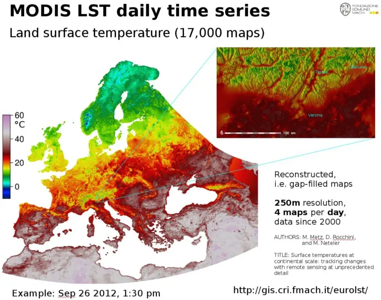
Field testing of remote sensing technologies (i.e., MODIS, Sentinel data, PRISMA) for the assessment of plant physiology traits (canopy temperature, vigour) or diseases. FEM will provide time series of NASA-MODIS and ESA-Copernicus satellite data, experimental fields, and instruments (i.e., spectroradiometers Spectral Evolution RS-5400, ASD Fieldspec PRO FR, etc.) to collect ground-truth data for the validation of remote-sensing models. In particular, FEM has 20 years of daily MODIS Land Surface Temperature images and weekly MODIS NDVI-EVI vegetation index maps. FEM has also been acquiring Sentinel-2 multispectral data at 10 m spatial resolution since 2017.
More about the service
How can the service help you?
The availability of ground-truth data is crucial for the calibration of remote sensing-based solutions. In addition, the expertise gained by FEM researchers over the years and the already available datasets will also be useful to improve the level of knowledge of the customers.
How the service will be delivered
Field activities at FEM’s experimental facilities will be carried out during the growing season. Data, models, and reports will be provided digitally.
Service customisation
Requirements and feasibility of services will be assessed individually.
Sector
Tree Crops
Viticulture
Test type
Data
Physical system
Software or AI model
Type of service
AI model training
Collection of test data
Data analysis
Performance evaluation
Provision of datasets
Test execution
Country of delivery
Country of delivery:

Service provider(s):
-
Fondazione Edmund Mach (FEM)
| Website