Description
Addressing the limitations of traditional approaches that rely on human supervision, FBK AgriRobot integrates cost-effective lidar, stereo vision, and Radio Frequency (RF)-based communication to assist robots in navigating without high-end network infrastructure.
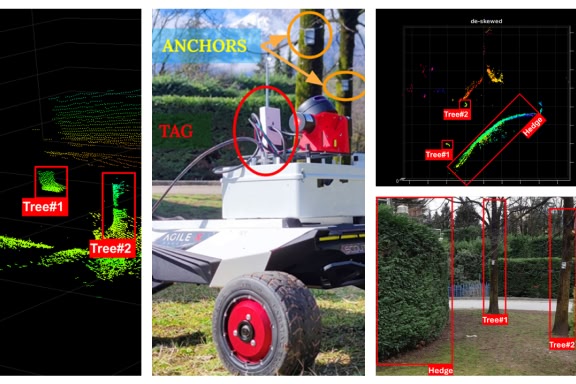
The project focuses on enhancing mobility and enabling robots to perform precision tasks such as crop and weed management, monitoring, and recognition. The core focus is to develop a robust and highly accurate localisation and navigation system for autonomous agricultural robots, capable of operating efficiently in large, unstructured outdoor settings. A key component of this effort is the use of 3D high-precision mapping, which provides detailed characterisation of agricultural land. This 3D point cloud data is critical for understanding the varying topographies and plant distributions across the farm, facilitating more accurate navigation and task execution by robots. It also enables more efficient resource allocation and targeted interventions, ensuring better yield management and reducing waste.
The entire solution operates at the edge, providing real-time data processing to support seamless robot navigation and decision-making in real-world farming scenarios.